UN
2 The Triangle
£ 72,000
Description
We don't have a Description for this property.
- Bedrooms
- 3
- Bathrooms
- 0
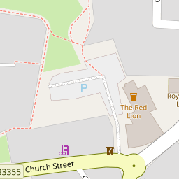


Leaflet © OpenStreetMap contributors
The heatmap indicates the level of crime in the area. The color of the heatmap indicates the crime severity and recency.
Metrics Year-on-Year
- Average area value
- 331,456.00 £Increased by 8.01 %
- Average area rental value
- 1,159.00 £/moIncreased by 11.44 %
- Est rental Yield
- 4.20 %Increased by 3.19 %
- Crime Rate
- 96.00 %Unchanged by 0.00 %
from 306,863.00 £
from 1,040.00 £/mo
from 4.07 %
from 96.00 %
Nearby Schools
| Name | Type | Ofsted | Distance |
|---|---|---|---|
| Paulton Infant School | Academy Converter | 0.42 KM | |
| Paulton Junior School | Community School | Outstanding | 0.42 KM |
| Paulton Children'S Centre | Children's Centre | 0.46 KM | |
| High Littleton Cofe Vc Primary School | Academy Converter | 1.67 KM | |
| Longvernal Primary School | Academy Converter | Good | 2.68 KM |
Images
Nearby Streets
| Name | Average Price | Average Sqft | Distance |
|---|---|---|---|
| Orchard Road | £ 435,000 | 0 | 0.00 KM |
| Clover Close | £ 289,950 | 0 | 0.00 KM |
| Meadow Road | £ 280,000 | 0 | 0.00 KM |
| Phillis Hill | £ 365,000 | 0 | 0.00 KM |
| Pinewood Road | £ 350,000 | 0 | 0.00 KM |
Nearby Listings
| Address | Price | Type | Score | Distance |
|---|---|---|---|---|
| Beautifully converted 1820's Victorian school house- Paulton | £ 515,000 | BUY | 6 / 10 | 0.07 KM |
| Trinity Close, Paulton, Bristol | £ 515,000 | BUY | 6 / 10 | 0.07 KM |
| Trinity Close, Paulton, BS39 | £ 550,000 | BUY | 7 / 10 | 0.09 KM |
| Green Close, Paulton | £ 379,950 | BUY | 6 / 10 | 0.12 KM |
| Williams Green, Paulton | £ 240,000 | BUY | Unknown | 0.13 KM |
Nearby Properties
| Address | Price | Distance |
|---|---|---|
| 3 The Triangle | £ 135,000 | 0.00 KM |
| 2 The Triangle | £ 72,000 | 0.00 KM |
| 1 The Triangle | £ 136,475 | 0.00 KM |
| 4 The Triangle | £ 125,000 | 0.00 KM |
| Old Vicarage | £ 810,000 | 0.05 KM |