UN
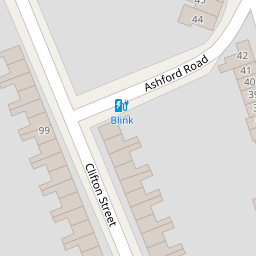
33 Ashford Road
£ 250,000
Description
We don't have a Description for this property.
- Bedrooms
- 3
- Bathrooms
- 0

Leaflet © OpenStreetMap contributors
The heatmap indicates the level of crime in the area. The color of the heatmap indicates the crime severity and recency.
Metrics Year-on-Year
- Average area value
- 216,052.00 £Decreased by 16.58 %
- Average area rental value
- 1,001.00 £/moIncreased by 9.52 %
- Est rental Yield
- 5.56 %Increased by 31.44 %
- Crime Rate
- 4.00 %Unchanged by 0.00 %
from 258,993.00 £
from 914.00 £/mo
from 4.23 %
from 4.00 %
Nearby Schools
| Name | Type | Ofsted | Distance |
|---|---|---|---|
| The Commonweal School | Academy Converter | Good | 0.50 KM |
| King William Street Church Of England Primary School | Academy Converter | Good | 0.90 KM |
| Lethbridge Primary School | Academy Converter | Good | 1.02 KM |
| Robert Le Kyng Primary School | Community School | Good | 1.07 KM |
| Utc Swindon | University Technical College | Requires improvement | 1.10 KM |
Images
Nearby Streets
| Name | Average Price | Average Sqft | Distance |
|---|---|---|---|
| Okus Road | £ 385,000 | 0 | 0.00 KM |
| Blackberry Alley | £ 240,000 | 0 | 0.00 KM |
| Market Street | £ 0 | 0 | 0.00 KM |
| Chester Street | £ 240,000 | 0 | 0.00 KM |
| Bow Court | £ 0 | 0 | 0.00 KM |
Nearby Transport
| Name | NLC | TLC | Distance |
|---|---|---|---|
| Swindon (Wilts) | 3333 | SWI | 1.35 KM |
Nearby Listings
| Address | Price | Type | Score | Distance |
|---|---|---|---|---|
| Ashford Road, Old Town, Swindon, SN1 | £ 280,000 | BUY | 5 / 10 | 0.05 KM |
| Ashford Road, Swindon, SN1 | £ 315,000 | BUY | 7 / 10 | 0.06 KM |
| Ashford Road, Old Town, Swindon, SN3 | £ 375,000 | BUY | 8 / 10 | 0.06 KM |
| Clifton Street - Old Town, Swindon, SN1 | £ 350,000 | BUY | Unknown | 0.07 KM |
| Clifton Street, Old Town, Swindon, SN1 | £ 350,000 | BUY | Unknown | 0.08 KM |
Nearby Properties
| Address | Price | Distance |
|---|---|---|
| 33 Ashford Road | £ 250,000 | 0.00 KM |
| 28 Ashford Road | £ 250,000 | 0.00 KM |
| 42 Ashford Road | £ 223,000 | 0.00 KM |
| 25a Ashford Road | £ 143,500 | 0.00 KM |
| 37 Ashford Road | £ 205,000 | 0.00 KM |