UN
4 South Street
£ 255,000
Description
We don't have a Description for this property.
- Bedrooms
- 3
- Bathrooms
- 0
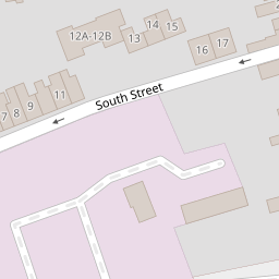

Leaflet © OpenStreetMap contributors
The heatmap indicates the level of crime in the area. The color of the heatmap indicates the crime severity and recency.
Metrics Year-on-Year
- Average area value
- 216,052.00 £Decreased by 16.58 %
- Average area rental value
- 1,001.00 £/moIncreased by 9.52 %
- Est rental Yield
- 5.56 %Increased by 31.44 %
- Crime Rate
- 5.00 %Unchanged by 0.00 %
from 258,993.00 £
from 914.00 £/mo
from 4.23 %
from 5.00 %
Nearby Schools
| Name | Type | Ofsted | Distance |
|---|---|---|---|
| King William Street Church Of England Primary School | Academy Converter | Good | 0.14 KM |
| Holy Rood Catholic Primary School | Academy Converter | Requires improvement | 0.48 KM |
| Lethbridge Primary School | Academy Converter | Good | 0.52 KM |
| The Commonweal School | Academy Converter | Good | 0.97 KM |
| Drove Children'S Centre | Children's Centre | 1.08 KM |
Images
Nearby Streets
| Name | Average Price | Average Sqft | Distance |
|---|---|---|---|
| Bow Court | £ 0 | 0 | 0.00 KM |
| Crombey Street | £ 0 | 0 | 0.00 KM |
| Regent Circus | £ 306,667 | 0 | 0.00 KM |
| Victoria Road | £ 0 | 0 | 0.00 KM |
| Blackberry Alley | £ 240,000 | 0 | 0.00 KM |
Nearby Transport
| Name | NLC | TLC | Distance |
|---|---|---|---|
| Swindon (Wilts) | 3333 | SWI | 1.31 KM |
Nearby Listings
| Address | Price | Type | Score | Distance |
|---|---|---|---|---|
| North Street, Old Town, Swindon, SN1 | £ 300,000 | BUY | Unknown | 0.05 KM |
| North Street, Swindon | £ 120,000 | BUY | Unknown | 0.06 KM |
| North Street, Swindon, SN1 3JY | £ 350,000 | BUY | 7 / 10 | 0.06 KM |
| Dover Street, Swindon, SN1 | £ 120,000 | BUY | 4 / 10 | 0.08 KM |
| Cross Street, Swindon, Wiltshire, SN1 3JT | £ 190,000 | BUY | 7 / 10 | 0.11 KM |
Nearby Properties
| Address | Price | Distance |
|---|---|---|
| 6 South Street | £ 285,000 | 0.00 KM |
| 4 South Street | £ 255,000 | 0.00 KM |
| 2 South Street | £ 323,000 | 0.00 KM |
| 17 South Street | £ 210,000 | 0.00 KM |
| 5 South Street | £ 242,500 | 0.00 KM |