UN
4 Ham Road
£ 505,000
Description
We don't have a Description for this property.
- Bedrooms
- 4
- Bathrooms
- 0
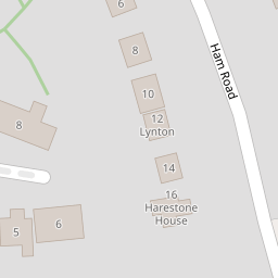

Leaflet © OpenStreetMap contributors
The heatmap indicates the level of crime in the area. The color of the heatmap indicates the crime severity and recency.
Metrics Year-on-Year
- Average area value
- 482,343.00 £Decreased by 5.50 %
- Average area rental value
- 1,295.00 £/moDecreased by 26.67 %
- Est rental Yield
- 3.22 %Decreased by 22.41 %
- Crime Rate
- 56.00 %Unchanged by 0.00 %
from 510,398.00 £
from 1,766.00 £/mo
from 4.15 %
from 56.00 %
Nearby Schools
| Name | Type | Ofsted | Distance |
|---|---|---|---|
| Wanborough Primary School | Community School | Good | 0.62 KM |
| Liden Academy | Academy Converter | 3.65 KM | |
| The Chalet School | Academy Special Sponsor Led | 3.68 KM | |
| Chiseldon Primary & Nursery School | Community School | Good | 4.03 KM |
| The Dorcan Academy | Academy Converter | Requires improvement | 4.12 KM |
Images
Nearby Streets
| Name | Average Price | Average Sqft | Distance |
|---|---|---|---|
| Mayfield | £ 525,000 | 0 | 0.00 KM |
| Chapel Lane | £ 0 | 0 | 0.00 KM |
| The Green | £ 635,000 | 0 | 0.00 KM |
Nearby Listings
| Address | Price | Type | Score | Distance |
|---|---|---|---|---|
| Hintons Croft, Wanborough, Swindon, SN4 | £ 850,000 | BUY | 7 / 10 | 0.01 KM |
| Hintons Croft, Wanborough, Swindon, SN4 | £ 899,950 | BUY | 8 / 10 | 0.01 KM |
| Hintons Croft, Wanborough, Swindon, SN4 | £ 850,000 | BUY | 7 / 10 | 0.01 KM |
| Hintons Croft, Wanborough, Swindon, SN4 | £ 850,000 | BUY | 7 / 10 | 0.01 KM |
| Church Road, Wanborough, Swindon, SN4 | £ 235,000 | BUY | 6 / 10 | 0.25 KM |
Nearby Properties
| Address | Price | Distance |
|---|---|---|
| 4 Ham Road | £ 505,000 | 0.00 KM |
| 16 Ham Road | £ 705,000 | 0.00 KM |
| Waterleigh | £ 515,000 | 0.02 KM |
| 12 Ham Road | £ 325,000 | 0.02 KM |
| 21 Warneage Green | £ 150,000 | 0.33 KM |