UN
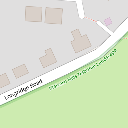
120 Longridge Road
£ 299,950
Description
We don't have a Description for this property.
- Bedrooms
- 3
- Bathrooms
- 0


Leaflet © OpenStreetMap contributors
The heatmap indicates the level of crime in the area. The color of the heatmap indicates the crime severity and recency.
Metrics Year-on-Year
- Average area value
- 431,723.00 £Decreased by 11.63 %
- Average area rental value
- 1,665.00 £/moIncreased by 9.47 %
- Est rental Yield
- 4.63 %Increased by 23.80 %
- Crime Rate
- 3.00 %Unchanged by 0.00 %
from 488,567.00 £
from 1,521.00 £/mo
from 3.74 %
from 3.00 %
Nearby Schools
| Name | Type | Ofsted | Distance |
|---|---|---|---|
| The Chase | Academy Converter | Good | 0.86 KM |
| Malvern Parish Cofe Primary School | Academy Converter | Good | 1.22 KM |
| Malvern College | Other Independent School | 1.39 KM | |
| Malvern St James | Other Independent School | 1.50 KM | |
| Great Malvern Primary School | Academy Converter | Good | 1.70 KM |
Images
Nearby Streets
| Name | Average Price | Average Sqft | Distance |
|---|---|---|---|
| Algol Way | £ 0 | 0 | 0.00 KM |
| Tudor Close | £ 340,000 | 0 | 0.00 KM |
| Hastings | £ 98,750 | 0 | 0.00 KM |
| Lawnside | £ 380,000 | 0 | 0.00 KM |
| Priory Road | £ 379,983 | 0 | 0.00 KM |
Nearby Transport
| Name | NLC | TLC | Distance |
|---|---|---|---|
| Great Malvern | 4892 | GMV | 1.36 KM |
| Malvern Link | 4884 | MVL | 3.17 KM |
| Colwall | 4876 | CWL | 4.95 KM |
Nearby Listings
| Address | Price | Type | Score | Distance |
|---|---|---|---|---|
| Longridge Road, Malvern | £ 285,000 | BUY | 6 / 10 | 0.00 KM |
| Murren Avenue, Malvern | £ 240,000 | BUY | 6 / 10 | 0.14 KM |
| Strothers Avenue, Malvern, WR14 | £ 280,000 | BUY | 8 / 10 | 0.17 KM |
| Strothers Avenue, Malvern | £ 300,000 | BUY | 6 / 10 | 0.24 KM |
| Strothers Avenue, Malvern, Worcestershire, WR14 | £ 255,000 | BUY | Unknown | 0.27 KM |
Nearby Properties
| Address | Price | Distance |
|---|---|---|
| 124 Longridge Road | £ 180,000 | 0.00 KM |
| 102 Longridge Road | £ 210,000 | 0.00 KM |
| 118 Longridge Road | £ 249,000 | 0.00 KM |
| 120 Longridge Road | £ 299,950 | 0.00 KM |
| 130a Longridge Road | £ 270,000 | 0.00 KM |