UN
7 Station Road
£ 63,000
Description
We don't have a Description for this property.
- Bedrooms
- 0
- Bathrooms
- 0

Leaflet © OpenStreetMap contributors
The heatmap indicates the level of crime in the area. The color of the heatmap indicates the crime severity and recency.
Metrics Year-on-Year
- Average area value
- 312,744.00 £Increased by 45.65 %
- Average area rental value
- 1,124.00 £/moIncreased by 8.81 %
- Est rental Yield
- 4.31 %Decreased by 25.30 %
- Crime Rate
- 25.00 %Unchanged by 0.00 %
from 214,716.00 £
from 1,033.00 £/mo
from 5.77 %
from 25.00 %
Nearby Schools
| Name | Type | Ofsted | Distance |
|---|---|---|---|
| Queens Ferry C.P. School | Welsh Establishment | 0.85 KM | |
| Sealand C.P. School | Welsh Establishment | 1.44 KM | |
| Sandycroft C.P. School | Welsh Establishment | 1.46 KM | |
| St Ethelwold'S Primary School | Welsh Establishment | 1.85 KM | |
| Plas Derwen | Welsh Establishment | 1.97 KM |
Images
Nearby Streets
| Name | Average Price | Average Sqft | Distance |
|---|---|---|---|
| Gladstone Way | £ 107,500 | 0 | 0.00 KM |
| Fford Pentre | £ 0 | 0 | 0.00 KM |
| Orchard Close | £ 210,000 | 0 | 0.00 KM |
| Llwyn Clwyd | £ 0 | 0 | 0.00 KM |
| Deiniol's Road | £ 110,000 | 0 | 0.00 KM |
Nearby Transport
| Name | NLC | TLC | Distance |
|---|---|---|---|
| Hawarden Bridge | 2146 | HWB | 1.65 KM |
| Shotton | 2546 | SHT | 1.81 KM |
| Hawarden | 2428 | HWD | 2.56 KM |
| Buckley | 2422 | BCK | 6.05 KM |
| Penyffordd | 2433 | PNF | 7.89 KM |
Nearby Listings
| Address | Price | Type | Score | Distance |
|---|---|---|---|---|
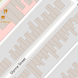
| Glynne Street, Queensferry, Deeside, Flintshire, CH5 | £ 80,000 | BUY | 5 / 10 | 0.10 KM |
| Fairfield Road, Deeside, CH5 | £ 280,000 | BUY | 5 / 10 | 0.15 KM |
| Dundas Street, Queensferry, CH5 | £ 115,000 | BUY | 7 / 10 | 0.22 KM |
| Dundas Street, Queensferry, Deeside, Flintshire, CH5 1SZ | £ 120,000 | BUY | 6 / 10 | 0.31 KM |
| Willow Park, Mancot, CH5 | £ 55,000 | BUY | Unknown | 0.53 KM |
Nearby Properties
| Address | Price | Distance |
|---|---|---|
| 21 Station Road | £ 47,000 | 0.00 KM |
| 7 Station Road | £ 63,000 | 0.00 KM |
| 34 Station Road | £ 85,000 | 0.04 KM |
| 64 Station Road | £ 55,000 | 0.04 KM |
| 32a Station Road | £ 46,000 | 0.05 KM |