UN
Avondale
£ 168,500
Description
We don't have a Description for this property.
- Bedrooms
- 3
- Bathrooms
- 0
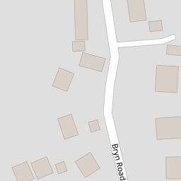

Leaflet © OpenStreetMap contributors
The heatmap indicates the level of crime in the area. The color of the heatmap indicates the crime severity and recency.
Metrics Year-on-Year
- Average area value
- 502,500.00 £Increased by 40.73 %
- Average area rental value
- 961.00 £/moDecreased by 1.13 %
- Est rental Yield
- 2.29 %Decreased by 29.97 %
- Crime Rate
- 5.00 %Unchanged by 0.00 %
from 357,077.00 £
from 972.00 £/mo
from 3.27 %
from 5.00 %
Nearby Schools
| Name | Type | Ofsted | Distance |
|---|---|---|---|
| Black Lane C.P. School | Welsh Establishment | 0.63 KM | |
| Ysgol Heulfan | Welsh Establishment | 1.32 KM | |
| Brynteg County School | Welsh Establishment | 1.38 KM | |
| Ysgol Bryn Alyn | Welsh Establishment | 1.70 KM | |
| St Mary'S Aided Primary School | Welsh Establishment | 1.71 KM |
Images
Nearby Streets
| Name | Average Price | Average Sqft | Distance |
|---|---|---|---|
| Francis Road | £ 350,000 | 0 | 0.00 KM |
| Woodland Road | £ 220,000 | 0 | 0.00 KM |
| Long Lane | £ 0 | 0 | 0.00 KM |
| Caer Haf | £ 210,000 | 0 | 0.00 KM |
| Westminster Road | £ 0 | 0 | 0.00 KM |
Nearby Transport
| Name | NLC | TLC | Distance |
|---|---|---|---|
| Gwersyllt | 4300 | GWE | 2.42 KM |
| Cefn-Y-Bedd | 2425 | CYB | 2.58 KM |
| Caergwrle | 2536 | CGW | 3.50 KM |
| Hope (Flintshire) | 2432 | HPE | 4.49 KM |
| Wrexham General | 4487 | WRX | 5.05 KM |
Nearby Listings
| Address | Price | Type | Score | Distance |
|---|---|---|---|---|
| Bryn Celyn, Moss, Wrexham | £ 325,000 | BUY | 7 / 10 | 0.07 KM |
| Bryn Road, Wrexham, LL11 | £ 175,000 | BUY | Unknown | 0.07 KM |
| Cerney Road, Moss, Wrexham, LL11 | £ 210,000 | BUY | 7 / 10 | 0.11 KM |
| Cerney Road, Moss, Wrexham | £ 250,000 | BUY | 6 / 10 | 0.12 KM |
| Cerney Road, Moss, Wrexham | £ 795,000 | BUY | 7 / 10 | 0.12 KM |
Nearby Properties
| Address | Price | Distance |
|---|---|---|
| Avondale | £ 168,500 | 0.00 KM |
| Kenningdale | £ 230,000 | 0.00 KM |
| The Bryn | £ 300,000 | 0.00 KM |
| Moss View | £ 195,000 | 0.09 KM |
| Kings Lyn | £ 178,500 | 0.09 KM |