UN
Marvin
£ 60,000
Description
We don't have a Description for this property.
- Bedrooms
- 3
- Bathrooms
- 0
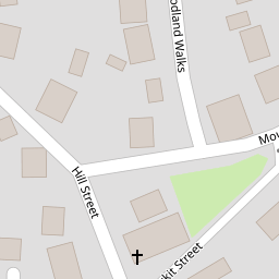


Leaflet © OpenStreetMap contributors
The heatmap indicates the level of crime in the area. The color of the heatmap indicates the crime severity and recency.
Metrics Year-on-Year
- Average area value
- 363,275.00 £Increased by 0.98 %
- Average area rental value
- 922.00 £/moDecreased by 1.28 %
- Est rental Yield
- 3.05 %Decreased by 2.24 %
- Crime Rate
- 56.00 %Unchanged by 0.00 %
from 359,732.00 £
from 934.00 £/mo
from 3.12 %
from 56.00 %
Nearby Schools
| Name | Type | Ofsted | Distance |
|---|---|---|---|
| Rhostyllen C.P. School | Welsh Establishment | 0.35 KM | |
| Ysgol Clywedog | Welsh Establishment | 2.12 KM | |
| Ysgol Penrhyn New Broughton Primary | Welsh Establishment | 2.87 KM | |
| Woodlands Children'S Development Centre | Welsh Establishment | 3.45 KM | |
| St Joseph'S Catholic And Anglican Secondary School | Welsh Establishment | 3.48 KM |
Images
Nearby Streets
| Name | Average Price | Average Sqft | Distance |
|---|---|---|---|
| Burkit Street | £ 0 | 0 | 0.00 KM |
| Chapel Street | £ 0 | 0 | 0.00 KM |
| Holmwood Avenue | £ 182,500 | 0 | 0.00 KM |
| Tudor Court | £ 0 | 0 | 0.00 KM |
| Trinity Street | £ 115,000 | 0 | 0.00 KM |
Nearby Transport
| Name | NLC | TLC | Distance |
|---|---|---|---|
| Wrexham General | 4487 | WRX | 3.45 KM |
| Wrexham Central | 4486 | WXC | 3.55 KM |
| Gwersyllt | 4300 | GWE | 4.60 KM |
| Ruabon | 4477 | RUA | 5.30 KM |
| Cefn-Y-Bedd | 2425 | CYB | 7.39 KM |
Nearby Listings
| Address | Price | Type | Score | Distance |
|---|---|---|---|---|
| Hill Street, Rhostyllen | £ 225,000 | BUY | 5 / 10 | 0.01 KM |
| Hill Street, Rhostyllen, Wrexham | £ 160,000 | BUY | 7 / 10 | 0.04 KM |
| Wilkinson Drive, Bersham, Wrexham | £ 350,000 | BUY | 6 / 10 | 0.14 KM |
| Plot 53 - The Berwyn, Phase 2, Manor Gardens, Wrexham Road, Rhostyllen, Wrexham | £ 290,000 | BUY | 6 / 10 | 0.14 KM |
| Plot 73 - The Richmond 2, Phase 2, Manor Gardens, Wrexham Road, Rhostyllen | £ 379,995 | BUY | 6 / 10 | 0.14 KM |
Nearby Properties
| Address | Price | Distance |
|---|---|---|
| Marvin | £ 60,000 | 0.00 KM |
| 1 Hill Street | £ 127,000 | 0.00 KM |
| 57 Hill Street | £ 140,000 | 0.00 KM |
| The Feathers | £ 192,500 | 0.00 KM |
| 24 Chapel Street | £ 65,500 | 0.06 KM |