UN
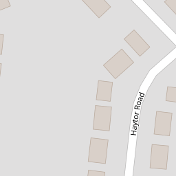
52 Haytor Road
£ 202,500
Description
We don't have a Description for this property.
- Bedrooms
- 4
- Bathrooms
- 0


Leaflet © OpenStreetMap contributors
The heatmap indicates the level of crime in the area. The color of the heatmap indicates the crime severity and recency.
Metrics Year-on-Year
- Average area value
- 363,275.00 £Increased by 0.98 %
- Average area rental value
- 922.00 £/moDecreased by 1.28 %
- Est rental Yield
- 3.05 %Decreased by 2.24 %
- Crime Rate
- 0.00 %
from 359,732.00 £
from 934.00 £/mo
from 3.12 %
from 0.00 %
Nearby Schools
| Name | Type | Ofsted | Distance |
|---|---|---|---|
| Wat'S Dyke C.P. School | Welsh Establishment | 0.44 KM | |
| Rhosddu Primary School | Welsh Establishment | 0.78 KM | |
| Ysgol Plas Coch | Welsh Establishment | 1.34 KM | |
| Alexandra C.P. School | Welsh Establishment | 1.38 KM | |
| Woodlands Children'S Development Centre | Welsh Establishment | 1.94 KM |
Images
Nearby Streets
| Name | Average Price | Average Sqft | Distance |
|---|---|---|---|
| Sussex Gardens | £ 265,000 | 0 | 0.00 KM |
| Derwent Close | £ 160,000 | 0 | 0.00 KM |
| Chester Road | £ 333,333 | 0 | 0.00 KM |
| Hazel Grove | £ 145,000 | 0 | 0.00 KM |
| Grange Avenue | £ 180,000 | 0 | 0.00 KM |
Nearby Transport
| Name | NLC | TLC | Distance |
|---|---|---|---|
| Wrexham General | 4487 | WRX | 1.58 KM |
| Wrexham Central | 4486 | WXC | 1.78 KM |
| Gwersyllt | 4300 | GWE | 3.00 KM |
| Cefn-Y-Bedd | 2425 | CYB | 5.91 KM |
| Caergwrle | 2536 | CGW | 6.79 KM |
Nearby Listings
| Address | Price | Type | Score | Distance |
|---|---|---|---|---|
| Ffordd Estyn, Wrexham, LL11 | £ 300,000 | BUY | 6 / 10 | 0.13 KM |
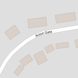
| Acton Gate, Wrexham | £ 330,000 | BUY | Unknown | 0.13 KM |
| Ffordd Estyn, Wrexham, LL11 | £ 350,000 | BUY | 8 / 10 | 0.13 KM |
| Kenyon Avenue, Wrexham | £ 165,000 | BUY | 7 / 10 | 0.25 KM |
| Sandringham Road, Wrexham | £ 275,000 | BUY | 6 / 10 | 0.27 KM |
Nearby Properties
| Address | Price | Distance |
|---|---|---|
| 52 Haytor Road | £ 202,500 | 0.00 KM |
| 60 Haytor Road | £ 212,500 | 0.00 KM |
| 61 Haytor Road | £ 187,500 | 0.00 KM |
| 65 Haytor Road | £ 146,000 | 0.00 KM |
| 64 Haytor Road | £ 250,000 | 0.00 KM |