UN
9 Arllwyn
£ 122,000
Description
We don't have a Description for this property.
- Bedrooms
- 3
- Bathrooms
- 0
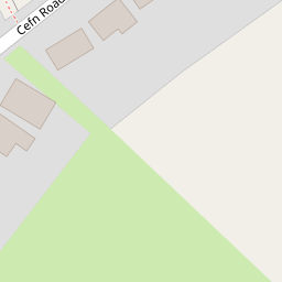

Leaflet © OpenStreetMap contributors
The heatmap indicates the level of crime in the area. The color of the heatmap indicates the crime severity and recency.
Metrics Year-on-Year
- Average area value
- 363,275.00 £Increased by 0.98 %
- Average area rental value
- 922.00 £/moDecreased by 1.28 %
- Est rental Yield
- 3.05 %Decreased by 2.24 %
- Crime Rate
- 26.00 %Unchanged by 0.00 %
from 359,732.00 £
from 934.00 £/mo
from 3.12 %
from 26.00 %
Nearby Schools
| Name | Type | Ofsted | Distance |
|---|---|---|---|
| Bwlchgwyn C.P. School | Welsh Establishment | 0.36 KM | |
| Carla House | Welsh Establishment | 1.42 KM | |
| Minera Aided Primary School | Welsh Establishment | 1.84 KM | |
| Ysgol Bryn Tabor | Welsh Establishment | 3.52 KM | |
| Penygelli Primary | Welsh Establishment | 3.57 KM |
Images
Nearby Streets
| Name | Average Price | Average Sqft | Distance |
|---|---|---|---|
| Cefn Road | £ 0 | 0 | 0.00 KM |
| Cae Glas Lane | £ 675,000 | 0 | 0.00 KM |
| School Road | £ 0 | 0 | 0.00 KM |
Nearby Transport
| Name | NLC | TLC | Distance |
|---|---|---|---|
| Cefn-Y-Bedd | 2425 | CYB | 7.25 KM |
| Caergwrle | 2536 | CGW | 7.51 KM |
| Hope (Flintshire) | 2432 | HPE | 7.74 KM |
| Gwersyllt | 4300 | GWE | 8.18 KM |
| Penyffordd | 2433 | PNF | 8.68 KM |
Nearby Listings
| Address | Price | Type | Score | Distance |
|---|---|---|---|---|
| Land at Cefn Road, Bwlchgwyn, Wrexham, LL11 5YE | £ 15,000 | BUY | 5 / 10 | 0.10 KM |
| Yr Hendy, Bwlchgwyn | £ 300,000 | BUY | 7 / 10 | 0.20 KM |
| Cae'r Efail, Bwlchgwyn, Wrexham | £ 220,000 | BUY | 6 / 10 | 0.81 KM |
| Ruthin Road, Bwlchgwyn, Wrexham | £ 395,000 | BUY | 6 / 10 | 0.91 KM |
| Stryt Maelor, Bwlchgwyn, Wrexham | £ 249,950 | BUY | 6 / 10 | 1.09 KM |
Nearby Properties
| Address | Price | Distance |
|---|---|---|
| 9 Arllwyn | £ 122,000 | 0.00 KM |
| 1 Arllwyn | £ 136,000 | 0.00 KM |
| 11 Arllwyn | £ 113,500 | 0.00 KM |
| 3 Arllwyn | £ 92,500 | 0.00 KM |
| 8 Brymbo Road | £ 100,000 | 0.23 KM |