UN
1 Tan Y Bryn
£ 262,000
Description
We don't have a Description for this property.
- Bedrooms
- 4
- Bathrooms
- 0
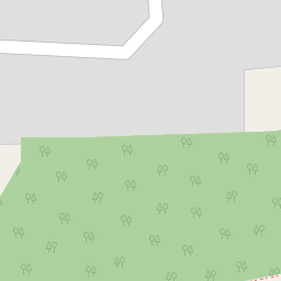
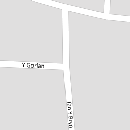

Leaflet © OpenStreetMap contributors
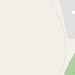
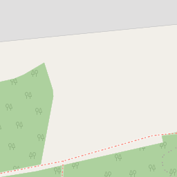
The heatmap indicates the level of crime in the area. The color of the heatmap indicates the crime severity and recency.
Metrics Year-on-Year
- Average area value
- 363,275.00 £Increased by 0.98 %
- Average area rental value
- 922.00 £/moDecreased by 1.28 %
- Est rental Yield
- 3.05 %Decreased by 2.24 %
- Crime Rate
- 8.00 %Unchanged by 0.00 %
from 359,732.00 £
from 934.00 £/mo
from 3.12 %
from 8.00 %
Nearby Schools
| Name | Type | Ofsted | Distance |
|---|---|---|---|
| Ysgol-Y-Grango | Welsh Establishment | 1.33 KM | |
| Ysgol Hooson | Welsh Establishment | 1.50 KM | |
| Ysgol Rhiwabon | Welsh Establishment | 1.77 KM | |
| Ysgol Maesyllan | Welsh Establishment | 2.49 KM | |
| St Mary'S Primary (Ruabon) School | Welsh Establishment | 2.52 KM |
Images
Nearby Streets
| Name | Average Price | Average Sqft | Distance |
|---|---|---|---|
| Poplar Avenue | £ 85,000 | 0 | 0.00 KM |
| Caernarvon Terrace | £ 0 | 0 | 0.00 KM |
| Charles Street | £ 117,500 | 0 | 0.00 KM |
| Mount Pleasant | £ 0 | 0 | 0.00 KM |
| Pinecroft | £ 0 | 0 | 0.00 KM |
Nearby Transport
| Name | NLC | TLC | Distance |
|---|---|---|---|
| Ruabon | 4477 | RUA | 2.13 KM |
| Wrexham Central | 4486 | WXC | 7.53 KM |
| Wrexham General | 4487 | WRX | 7.54 KM |
| Chirk | 4449 | CRK | 8.01 KM |
| Gwersyllt | 4300 | GWE | 8.53 KM |
Nearby Listings
| Address | Price | Type | Score | Distance |
|---|---|---|---|---|
| Cemetery Road, Rhosllanerchrugog, Wrexham | £ 189,950 | BUY | Unknown | 0.38 KM |
| Gardden Road, Rhosllanerchrugog, Wrexham | £ 149,950 | BUY | 6 / 10 | 0.47 KM |
| Ffordd Offa, WREXHAM, Clwyd, LL14 | £ 200,000 | BUY | Unknown | 0.49 KM |
| Ffordd Dyfed, Wrexham, LL14 | £ 170,000 | BUY | Unknown | 0.50 KM |
| Pen Y Graig, Rhosllanerchrugog | £ 190,000 | BUY | 5 / 10 | 0.50 KM |
Nearby Properties
| Address | Price | Distance |
|---|---|---|
| 4 Tan Y Bryn | £ 120,000 | 0.00 KM |
| 1 Tan Y Bryn | £ 262,000 | 0.00 KM |
| 33 Tan Y Bryn | £ 177,000 | 0.00 KM |
| 20 Tan Y Bryn | £ 111,000 | 0.00 KM |
| 29 Tan Y Bryn | £ 170,000 | 0.01 KM |