UN
4 Thornhurst Drive
£ 239,000
Description
We don't have a Description for this property.
- Bedrooms
- 4
- Bathrooms
- 0
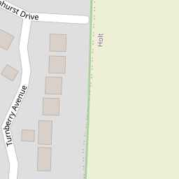

Leaflet © OpenStreetMap contributors
The heatmap indicates the level of crime in the area. The color of the heatmap indicates the crime severity and recency.
Metrics Year-on-Year
- Average area value
- 363,275.00 £Increased by 0.98 %
- Average area rental value
- 922.00 £/moDecreased by 1.28 %
- Est rental Yield
- 3.05 %Decreased by 2.24 %
- Crime Rate
- 3.00 %Unchanged by 0.00 %
from 359,732.00 £
from 934.00 £/mo
from 3.12 %
from 3.00 %
Nearby Schools
| Name | Type | Ofsted | Distance |
|---|---|---|---|
| Ysgol Morgan Llwyd | Welsh Establishment | 1.28 KM | |
| Barker'S Lane C.P. School | Welsh Establishment | 1.48 KM | |
| Ysgol Rhosnesni | Welsh Establishment | 1.62 KM | |
| Hafod - Y - Wern Community Primary School | Welsh Establishment | 1.75 KM | |
| St Anne'S R.C. Primary School | Welsh Establishment | 1.87 KM |
Images
Nearby Streets
| Name | Average Price | Average Sqft | Distance |
|---|---|---|---|
| Blantern Way | £ 267,317 | 0 | 0.00 KM |
| Willow Court | £ 0 | 0 | 0.00 KM |
| Brecon Close | £ 0 | 0 | 0.00 KM |
| Conway Drive | £ 0 | 0 | 0.00 KM |
| Lumley Close | £ 0 | 0 | 0.00 KM |
Nearby Transport
| Name | NLC | TLC | Distance |
|---|---|---|---|
| Wrexham Central | 4486 | WXC | 4.53 KM |
| Wrexham General | 4487 | WRX | 4.82 KM |
| Gwersyllt | 4300 | GWE | 6.73 KM |
| Cefn-Y-Bedd | 2425 | CYB | 9.24 KM |
| Caergwrle | 2536 | CGW | 9.96 KM |
Nearby Listings
| Address | Price | Type | Score | Distance |
|---|---|---|---|---|
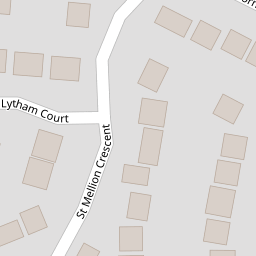
| Turnberry Avenue, Wrexham | £ 395,000 | BUY | 7 / 10 | 0.10 KM |
| St Mellion Crescent, Wrexham | £ 375,000 | BUY | 7 / 10 | 0.12 KM |
| Muirfield Close, Wrexham | £ 375,000 | BUY | 7 / 10 | 0.23 KM |
| Gredington Close, Wrexham | £ 310,000 | BUY | 7 / 10 | 0.33 KM |
| St. Andrews Crescent, Wrexham | £ 385,000 | BUY | Unknown | 0.38 KM |
Nearby Properties
| Address | Price | Distance |
|---|---|---|
| 1 Thornhurst Drive | £ 245,000 | 0.00 KM |
| 3 Thornhurst Drive | £ 275,000 | 0.00 KM |
| 5 Thornhurst Drive | £ 248,000 | 0.00 KM |
| 2 Thornhurst Drive | £ 337,500 | 0.00 KM |
| 4 Thornhurst Drive | £ 239,000 | 0.00 KM |