UN
202 Fernhill Road
£ 65,000
Description
We don't have a Description for this property.
- Bedrooms
- 2
- Bathrooms
- 0
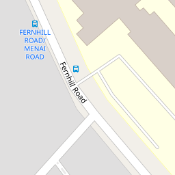
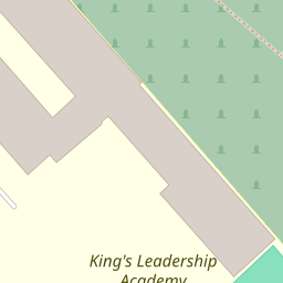


Leaflet © OpenStreetMap contributors
The heatmap indicates the level of crime in the area. The color of the heatmap indicates the crime severity and recency.
Metrics Year-on-Year
- Average area value
- 172,617.00 £Decreased by 13.74 %
- Average area rental value
- 835.00 £/moIncreased by 18.61 %
- Est rental Yield
- 5.80 %Increased by 37.44 %
- Crime Rate
- 9.00 %Unchanged by 0.00 %
from 200,116.00 £
from 704.00 £/mo
from 4.22 %
from 9.00 %
Nearby Schools
| Name | Type | Ofsted | Distance |
|---|---|---|---|
| King'S Leadership Academy Hawthornes | Free Schools | Requires improvement | 0.12 KM |
| Greenacre Community Nursery School | Local Authority Nursery School | Good | 0.27 KM |
| Springwell Park Community Primary School | Community School | Good | 0.35 KM |
| Springwell Park Children'S Centre | Children's Centre | 0.35 KM | |
| St Robert Bellarmine Catholic Primary School | Voluntary Aided School | Outstanding | 0.60 KM |
Images
Nearby Streets
| Name | Average Price | Average Sqft | Distance |
|---|---|---|---|
| Menai Road | £ 0 | 0 | 0.00 KM |
| Aughton Road | £ 0 | 0 | 0.00 KM |
| St. Elizabeth Avenue | £ 0 | 0 | 0.00 KM |
| Spencer Place | £ 150,000 | 0 | 0.00 KM |
| Smith Drive | £ 145,000 | 0 | 0.00 KM |
Nearby Transport
| Name | NLC | TLC | Distance |
|---|---|---|---|
| Bootle New Strand | 2195 | BNW | 1.60 KM |
| Walton (Merseyside) | 2251 | WAO | 2.13 KM |
| Bootle Oriel Road | 2239 | BOT | 2.24 KM |
| Orrell Park | 2247 | OPK | 2.27 KM |
| Seaforth And Litherland | 2250 | SFL | 2.44 KM |
Nearby Listings
| Address | Price | Type | Score | Distance |
|---|---|---|---|---|
| Menai Road, Bootle | £ 220,000 | BUY | 8 / 10 | 0.16 KM |
| Mary Road, Orrell, Liverpool, L20 | £ 230,000 | BUY | Unknown | 0.18 KM |
| Mary Road, Liverpool, Merseyside, L20 | £ 234,950 | BUY | 7 / 10 | 0.19 KM |
| Springwell Road, Litherland, Merseyside, L20 | £ 175,000 | BUY | 6 / 10 | 0.31 KM |
| 67 SPRINGWELL ROAD, BOOTLE, MERSEYSIDE | £ 40,000 | BUY | 5 / 10 | 0.32 KM |
Nearby Properties
| Address | Price | Distance |
|---|---|---|
| 202 Fernhill Road | £ 65,000 | 0.00 KM |
| 178 Fernhill Road | £ 88,000 | 0.02 KM |
| 22 Grogan Square | £ 52,000 | 0.11 KM |
| 16 Grogan Square | £ 66,000 | 0.11 KM |
| 10 Mahon Avenue | £ 79,950 | 0.14 KM |